Monday, August 4, 2025

Deep Soak

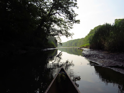
I put in on the Pawcatuck. It is calm and 70F with clear skies, and nothing about that should change other than the temperature, which will rise to the mid 80's. 

One person is at the launch site and he is fishing.  I put the canoe in the water and turn upstream.  In five minutes of paddling, I pass under a railroad bridge. At this point the river turns away from the road and heads out into the Great Swamp. It gets quiet pretty quickly.  

The water is lower than usual for most of my trips here.  It is probably only a matter of a half foot or so, but the difference causes some narrow patches of silty-sand to be exposed.  On most of my trips here, the water runs right into the shoreline shrubs. There is almost no current, only the lean of submerged water plants suggests the flow.

Just below Burdickville, I spot a mink running on the right bank.  I get my camera ready, and although I miss the fully exposed running photo, I know that the mink will give me another chance.  I have never seen a mink that could resist coming back to take a second or third look. 

I make the awkward portage of the Burdickville dam ruins.  It is always awkward, no matter what the water level is, but it is only 30 feet.  There is more current above Burdickville and it slowly picks up pace the farther upriver I get.  The river bottom becomes cobbles, boulders and gravel. It's ice age stuff - all rounded from being tumbled under the ice.  The pitch pines start to show in force as well.  Below the dam ruins, it was mostly oaks and swamp maples.  Above, there are glacial sand deposits and dunes that pitch pines like to grow in. This part of the river has a lot of downed timber in the water to maneuver around.  The game warden types do some clearing, but they keep it to a minimum as the downed wood is good for fish.

I spot the first Osprey of the day.  It has been a very quiet day for birds with just a couple Cormorants, this Osprey, and 2 Great Blue Herons. But, this is a narrow river running through a very wide swamp with a lot of good habitat - everything does not need to be on the river.

I turn back as the Kings Factory Bridge comes into view.  The water is shallow and fast at this point and I would have to wade to get higher.  As it is, I am about 7 miles out and feel totally deep soaked in the surroundings. 

I take out after 14 miles and 4-1/2 hours of paddling.  I saw no one else other than two people fishing from the Burdickville bridge. 


Sunday, August 3, 2025

Return of the Juveniles

I head across town to the state boat launch, my usual put in for a visit to the tidal section of the Housatonic.  I get the last parking spot. I put my canoe in the water as fast as possible and head down to the marsh and away from the "boat mall".

The tide is almost all the way out.  My route in the marsh will be very limited, but I knew this already.

Common Terns are common right now.  They do summer in this region, but they haven't been in the marsh until recently.  I imagine that their nesting is over and they are coming here to feed on the plentiful tiny fish that are recently hatched. There are 15-20 of them perched on the last dock before the marsh.

Juvenile Yellow Crowned Night Heron

The other bird of notice is the juvenile Yellow Crowned Night Herons.  Today, my sightings of the juveniles outnumber the adults maybe 3 to 1.  I'm sure the actual numbers are more even, but the juveniles are probably more likely to be at the water's edge as they learn to hunt. There are also a good number of Great and Snowy Egrets.  I imagine some of them are juveniles, but I don't know how, or if, there is a way to differentiate them from the adults. Yellow Legs are also back in the marsh after nesting up in the Hudson Bay latitudes

Probably a Semipalmated Sandpiper

I head back early.  The idea of having to take out amongst a small army of motorboaters has nagged at me while I've been out. I have little in common with any of them and taking out at a launch full of them is like finishing a long canoe trip in a shopping mall parking lot.  Maybe someday I will be big enough to overlook this, but that day is not now.

Saturday, August 2, 2025

To the Shephaug Cascades

 It is just too nice to not be outside.  It is in the 70's with a light north wind, low humidity and a blue sky. The trick will be to avoid the crowds.

I put in at Pond Brook, which is actually a pleasant and somewhat secluded cove, the result of the main river being dammed in the 1950's.  I head out and then down river, rounding the point where the Shephaug River joins.  The Shephaug arm is one of the best stretches in the reservoir with maybe half of the shoreline being forest preserve, and most of the well-spaced houses being up and away from the water and often hidden in the trees.

It is already past 10AM but even so, there are only a few bass boats. It's a general rule that the typical motorboat owner can't get it together until noon, even on a weekends.  

As I cross the shallow bay near the halfway point, I scan the trees for Eagles, which often perch here.  Finding none, I put my head down and motor on, just as a scratchy whistle comes down from high. I look up and there, about 500 feet up, is a mature Bald Eagle gliding south. 

I make good time up to the Shephaug cascades - hour and a half for just short of five miles. The water is murky in the last quarter mile and I figure that it is mostly runoff silt from recent rains. The water here is also several degrees colder than that downstream, where there is definitely a good crop of algae growing. In fact, it would be a chilly swim. 

I turn and head back, stopping at the old railroad culvert.  It is shrouded with overhanging tree branches, and as I push in, a Great Blue Heron flushes from those very branches, not eight feet away.  

I continue out and at the shallow halfway bay, find the Eagle perched in a tall snag well up the hillside.

Just ten minutes after noon, a pair of waterski boats come by...right on cue.   

Thursday, July 31, 2025

Wildlife Check

A few days of steaming hot weather have passed. Chance of rain and thunderstorms is today's prediction, so I set out for someplace with a bit of protection, just in case.

I put in on the Mattebasset, in the usual spot.  Besides having some protection from weather, it seemed to me to be time to check on the beaver population.  It is overcast and in the 70's, but the air is quite humid although it does not look at all like it will rain much.

This river looks like perfect beaver habitat, and not only to humans, but to beaver as well.  There is plenty of food and building materials with miles of riverbank that is ideal for lodges or bank burrows, and there is a significant buffer from built up areas.  There is, however, a problem - the area floods, and it floods big.  As I paddle downriver, I think about the numerous beaver lodges that I've seen come and go.  I'm pretty sure that it is a rare lodge that has lasted three years, and something like one to two years is more common. When it floods here, the water usually stays up for ten days to two weeks. In one instance, I saw beaver flooded out of their lodge dig new bank burrows on the far side of the river.  Of course, when the water level dropped, the bank burrow entrance tunnels were no longer submerged and the burrow was at risk from predators, so the bank burrows were abandoned, and the original lodge was caving in due to the flood.

I keep my eyes pealed looking for beaver sign.  Before the most recent flood at the end of March, there was a nonstop series of scent mounds for a quarter mile above the Point Lodge. Closer to the lodge were numerous fresh cuts and peals.  Today, there is not a single scent mound.  There are no fresh peels or cuts, no beaver sticks (branches with the bark peeled off), no sign of any beaver activity.  The lodge is still standing and obvious, but it is just a pile of wood without the mud that works as mortar and weather sealing.  This lodge was fully submerged in the March flood.  Similarly, the bank burrow at the top of Boggy Meadow (the official name of the largest open marsh area) looks abandoned, mainly due to the lack of any active sign in the surroundings. 

I wonder how long it will be until new beaver start colonizing this part of the river.  Beaver are territorial and two year-old adolescents are kicked out of the parental colony to go find there own place.  Eventually, their going to get in here and build a lodge.

I come across a Great Blue Heron about every quarter mile as I head down.  I find 4 Great Egrets in Boggy Meadow, noting that the Egrets are not nearly so territorial as the Herons.  Kingfishers are also common today.  I head down to the Connecticut River and circle Wilcox Island, which lies right off the mouth of the Mattebasset.  I flush an immature Bald Eagle from the upper part of the island. Then I head back upriver.  


 At the top of Boggy Meadow I find a mature Bald Eagle perched over the Tepee Lodge ruins.  I get a few photos, and when looking at them later, notice that the Eagle has tags on both legs.   

There has been no thunder, no rain, just some fairly pleasant wind to move the humidity about. 

Sunday, July 27, 2025

A Rant

There is a possibility of thunderstorms and while it looks like most of the weather will pass by to the north, paddling in a wide open salt marsh is less than prudent, for sure.

I put in at Indian Well State Park.  The gate attendant hands me a 1/2 sheet of paper with a list of things I cannot do.  No alcohol or weed, no boom boxes, no bouncy castles.  I tell him that I am just launching my canoe and I don't need the flyer, but he says I have to take it.

I head out into the river and swing wide around the park shoreline.  It is apparently a very popular park and looks like it will reach the 350 car maximum even on this gray day.  It takes 10 minutes of paddling to get upstream of the park where I can return to the west shore and paddle up against the forest. The air is murky with humidity that doesn't have enough gumption to form raindrops.


After Boy Scouts, my outdoor life continued by taking up mountain climbing.  At that time it was a somewhat self taught skill, until you were good enough that a more experienced climber might take interest in you. It is no more like that unless one takes a luddite approach and avoids the climbing gyms and speed climbing B.S. and referring to the activity as a "sport".  I haven't climbed in many years, but on occasion when it comes up in conversation and I find someone who has done some climbing, I am overwhelmingly likely to find that the person has never climbed outdoors.  I find this profoundly weird and best to just let the topic drift away. Climbing was about a connection to wildness, and climbing in a gym is... gymnastics.  

What brought this on was my irritation with what passes for periodicals.  In my climbing days, I could pick up at least four different monthly magazines about climbing.  I would probably have met more of my goals if I had ignored some of them, but they did keep one in touch with new developments and how people were pushing the limits... and how often some of those people died.  At this same time were similar backpacking, kayaking and canoeing magazines that performed similar tasks.

I am now a fairly avid canoeist logging something like 80 or 90 days a year on an average.  The magazines are replaced with a few web publications that spew a fair amount of product placement barf...it's cheap to pump that shit out when you don't actually have to print it on paper. I have no doubt that most of what is most interesting remains undocumented.  

So, besides this blog, which I have written for 16 years, I watch a few online chat groups.  Mostly, I am interested in catching a tip on a paddling location or repair methods. Unfortunately, what I more often find are debris postings - gripes about roof racks, dweeby questions about electronic gadgets - or "what kind of gun do you carry to protect yourself from wolves and bears?" (yeah, that last one is real).  I finally addressed that last one by asking the person, "why are you afraid of wolves and bears?"   Several other people followed me on that one and the gun topic thing disappeared.  To be fair, it is a legitimate question for traveling in the very far north, but it is a dumbshit question unless you are traveling in Alaska or the sub-Arctic.  But that is the internet - a place where everyone can say something that should have been cut by an editor.


As I paddle upriver, I spot a Great Blue Heron standing at rest on the shore.  As I near, I realize that there are twenty two Mallards sitting on the shoreline right under the Heron.  

I continue up to the rapids, which is flowing easy today.  There is a guy fishing at the top of the fast water, so I turn back early and let him continue undisturbed. 


Saturday, July 26, 2025

Low Tide

I put in at Foote Bridge.  The tide is low, and taking into account the lag caused by four and a half miles of river, it is pretty near the bottom and I will have some wading to do. In fact, I have to wade away from my put-in.  Tidal timing can make a trip easy or hard, and in places with narrow passages, impossible unless one has time to wait for nature to catch up with your plans.  The timing of my start has one purpose - I will have the upper section of the river to myself.

I wade four short patches on my way down to the first bend. In between, it is half paddle dipping and coasting in four to six inches of water.  I pass a Green Heron at the last bend above the Gravel Flats. Over the Flats are five Osprey circling while a couple of Great Egrets, four Snowy Egrets, and a Great Blue Heron are fishing the shallows.  The Gravel Flats is probably good hunting for the Snowys, which will take the smallest fish as well as using their feet to kick critters loose from the gravel. I have to wade all of the Gravel Flats - maybe a 150 to 200 yards. It is easy wading with a firm pea gravel bottom that only gets muddy as the water becomes deep enough to be back in the canoe.
Green Heron

It is in the mid-70's with a light wind and enough humidity that it can be seen when I have a long view. It is just thick enough to be cooling. 

It is peaceful.

I don't see anyone until I near the Post Road.  Two tubers are putting in from the rip-rap boulders and as they are in the pre-drowning stage of their trip, I pass by silently. It is a lousy put-in that people who write lousy guidebooks recommend.  While one can park close to the water, getting into one's boat requires stepping off of large rip-rap boulders into an already floating boat.

The tide is coming in, but the water is still to low to paddle the Sneak.  I spot a few Willets along the river, but with nesting and fledging over, most of them have moved off.  

The Long Cut

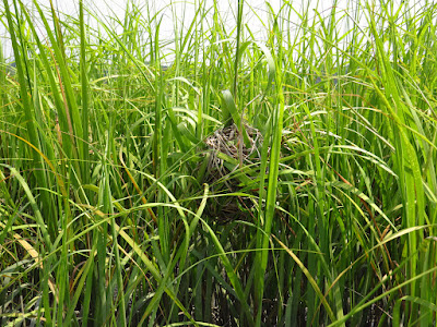
I pass another set of six tubers just before turning into the Long Cut - a longer alternative to the Sneak.  I explore one side channel that heads east and peters out after a couple hundred yards.  Then, I return and push into the Long Cut.  It is grown in with spartina, and if one didn't know it was here, one would never suspect that there was a channel. I surprise a hen Mallard from about 6 feet as I go.  The channel opens up after five or six canoe lengths.  The hen Mallard is waiting for me and I suspect that there might be young stashed back where I first surprised her.  She dives to get behind the canoe and heads back to where I first saw her.  I find a couple of dummy Marsh Wren nests as I head back to the East River.  Male Marsh Wrens build several nests in a small area with the female selecting and finishing only one of them.  

Marsh Wren dummy nest

In the Big Bends, I run into the first set of tubers and tip them off about the state boat ramp at the bottom of the river.  

It is an easy paddle without a hint of wading back to my start point. 

Wednesday, July 23, 2025

Oyster River

I hadn't been in the Oyster River for quite some time. It must be at least a couple years (in fact, it was August of 2023). It is a calm and sunny day with light winds developing and a high temperature in the low 80's.  

The trip begins with a 60 rod portage that descends about 75 feet. From there, I head east on the calm water of Long Island Sound, tucking under the hundred year old gazebo bridge of Point Rosa, through the gap in the rocky point off Anchor Beach, and over the sand bar off of Oyster River.  My first time in here was just after Hurricane Sandy and the reason for the name, "Oyster River", escaped me as the bottom was all sand.  It would take more than a year for the sand that had been washed into the river to wash back out and show the reason for the name.  For the first quarter mile, the bottom of the river is nothing but oysters.  It is also quite shallow and requires a near high tide to avoid scraping the bottom off the canoe. 

I ride the flood current in, with about a hour to go until high tide, duck under the only bridge, pass through the old trolley line bridge foundations and out into a small protected salt marsh.  There are numerous Great Egrets and maybe half again as many Snowy Egrets, maybe a dozen of the former and nearly twenty of the later.  There are also quite a few Killdeer, more than I have seen in one place for quite some time.

The water is still shallow and I often have to get to the outside of each bend to get deep enough water. A large Hawk overflies me, but when it perches, it is clearly an Owl. I don't get a good look at it, but by size and shape, it is probably a Barred Owl.  I paddle all the way up to the next road - about 3/4 of a mile, and there seem to be Killdeer in each bend. 

I head back out, with an unidentified medium-sized Hawk flying past as I near the mouth.  A light wind has come up and there is a small chop as I make my way back.  The trip ends with a 60 rod portage that ascends about 75 feet.